Climate change adaptation strategies face unprecedented challenges as new data reveals a staggering 400% increase in extreme weather events since 1950. This alarming surge highlights the accelerating pace of climate disruption worldwide. Recent research shows that heatwaves have tripled in frequency since 1980, while compound events—where multiple climate hazards occur simultaneously—have become increasingly common throughout 2023-2024.
Furthermore, these weather extremes aren’t merely statistical anomalies; they represent a fundamental shift in our planet’s climate systems. Scientists now confidently attribute many of these events to human activities, specifically greenhouse gas emissions and land use changes. Consequently, understanding these patterns has become crucial for developing effective adaptation strategies. This article examines the definition and measurement of extreme weather events, analyzes their connection to human activities, and explores projections under various warming scenarios. By understanding these trends, communities and policymakers can better prepare for the climate challenges ahead.

Defining Extreme Weather Events and the 400% Surge
The Intergovernmental Panel on Climate Change (IPCC) establishes precise definitions to differentiate between short-term weather anomalies and longer climate disruptions. According to the IPCC, an extreme weather event is “an event that is rare at a particular place and time of year,” whereas an extreme climate event refers to “a pattern of extreme weather that persists for some time, such as a season” [1]. This distinction proves critical when analyzing both immediate impacts and long-term climate trends.
IPCC Definition of Weather vs Climate Extremes
The concept of “rare” in climate science encompasses various interpretations. Some researchers classify an event as extreme only if unprecedented, though others consider events occurring several times annually as moderate extremes [1]. Notably, what constitutes “rare” shifts under human-induced climate change—making previously unprecedented events increasingly probable under current conditions [1]. This shifting baseline complicates both scientific analysis and public perception of extremes.
An extreme can manifest as unusual magnitude, location, timing, or extent of a weather phenomenon [2]. Certain climate extremes like droughts or floods may result from an accumulation of weather events that individually appear normal but collectively form extreme patterns [2]. Additionally, not all technical extremes produce serious impacts, though many do cause widespread adverse effects [3].
Threshold Metrics: 90th Percentile and Return Periods
Scientists employ two primary approaches to define extremes:
- Relative thresholds (e.g., 90th percentile of temperature distribution)
- Absolute thresholds (e.g., 35°C for a hot day)
The percentile-based method adjusts for regional and seasonal variations, allowing extremes to occur globally throughout the year [4]. For instance, days exceeding the 90th percentile threshold would theoretically represent 10% of days when evaluated against the same baseline period [4]. The ETCCDI (Expert Team on Climate Change Detection and Indices) recommends using 1961-1990 as the standard 30-year baseline, often employing a 5-day running window across the seasonal cycle to increase sample size [4].
Changes in extremes can be examined from dual perspectives—either focusing on frequency changes of given extremes or on intensity shifts [1]. At the same time, temporal scale matters significantly; hourly precipitation extremes often exhibit distinct features compared to daily measurements, including rapid onset and localized impacts [5].
Observed Global Trends Since 1950
Evidence from observations since 1950 demonstrates clear changes in extreme patterns globally. The frequency and intensity of hot extremes (including heatwaves) have increased, while cold extremes have decreased on the global scale—a trend assessed with “virtually certain” confidence [1]. This pattern applies regionally as well, with more than 80% of assessed regions showing similar changes [1].
Particularly concerning is how these extremes scale with global warming. Research indicates that extreme temperatures on land tend to increase more rapidly than the global mean temperature, primarily due to the land-sea warming contrast and regional feedback mechanisms [1]. Moreover, the frequency of hot temperature extremes increases nonlinearly with global warming, with larger percentage increases occurring for rarer events [1].
Beyond temperature, heavy precipitation events have shown statistically significant increases in more regions than decreases, though with substantial regional variations [2]. The World Meteorological Organization reports the number of disasters has increased by a factor of five over the past 50 years, driven by climate change, more extreme weather, and improved reporting [3].
Attribution of Extreme Events to Human Activity
Scientific evidence now establishes that human influence is undeniably altering extreme weather patterns worldwide. The Intergovernmental Panel on Climate Change (IPCC) confirms it is an established fact that human-induced greenhouse gas emissions have led to increased frequency and intensity of some weather and climate extremes since pre-industrial times [6]. Indeed, attribution science has strengthened considerably in recent years, providing clearer links between human activities and various extreme events.
Greenhouse Gas Forcing and Radiative Imbalance
Human-induced greenhouse gas forcing stands as the primary driver behind observed changes in temperature extremes globally—a conclusion scientists consider virtually certain [6]. This fundamental climate disruption stems from radiative forcing imbalance, which represents the difference between the energy Earth absorbs from the sun and the energy it radiates back to space [7]. Essentially, this imbalance functions like a global energy budget deficit where more energy enters than leaves our planetary system.
The Annual Greenhouse Gas Index reached 1.51 in 2023, indicating a 51% increase in radiative forcing (warming influence) since 1990 [8]. Carbon dioxide accounts for the largest share of this forcing, and alone would contribute a 42% increase since 1990 [8]. This positive radiative forcing creates a persistent energy imbalance measured in watts per square meter, representing the size of the energy deficit in our atmosphere [8]. The resulting accumulation of heat drives both gradual warming and the intensification of extreme weather events.
Land Use and Aerosol Feedbacks on Regional Extremes
Although greenhouse gasses drive global patterns, regional processes either moderate or amplify their effects. These include soil moisture dynamics, snow/ice-albedo feedbacks, and land-use changes [6]. In transitional climate regions between dry and wet climates, soil moisture variability directly affects evapotranspiration, thus influencing heat exchange [9]. During periods with high soil moisture limitation, such as seasonal or occasional droughts, temperatures rise substantially [9].
Human modifications to landscapes also play crucial roles. Irrigation and crop expansion have attenuated increases in summer hot extremes in some regions, such as the Midwestern USA [6]. Conversely, aerosol concentrations have likely affected trends in hot extremes in certain regions [6]. This relationship is complex—some aerosols like sulfates reflect sunlight and create cooling effects, whereas others such as black carbon absorb solar radiation and contribute to warming [10]. Overall, changes in anthropogenic aerosol concentrations have likely influenced extreme temperature trends regionally [11].
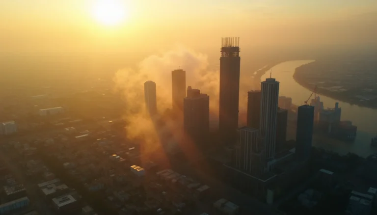
Urban Heat Island Effects on Nighttime Temperatures
Urbanization has significantly altered temperature patterns, creating “heat islands” where cities experience notably higher temperatures than surrounding areas. Research shows that in the United States, urban areas experience daytime temperatures about 1–7°F higher than outlying areas and nighttime temperatures about 2–5°F higher [2]. Humid regions and cities with larger, denser populations experience the greatest temperature differences [2].
Urban heat islands particularly exacerbate nighttime temperature extremes [6]. This occurs because buildings, pavements, and parking lots block heat from rising into the night sky [12]. The impacts extend beyond discomfort—heat islands increase electricity demand for air conditioning by 1–9% for each 2°F temperature increase [2]. During extreme heat events, this increased demand can overload energy systems [13].
The health consequences are substantial. One study estimates that across 93 European cities, heat islands cause approximately 6,700 premature deaths annually, corresponding to 4% of all summer deaths [13]. Heatwave duration and intensity have also increased over the last 40 years, creating a dangerous combination with the urban heat island effect [13]. As both urbanization and climate change accelerate, these effects will likely intensify unless adaptation strategies are implemented.
Breakdown of Key Extreme Events by Type
The frequency and intensity of extreme weather events have risen dramatically in recent decades, with distinct patterns emerging across different event types.
Heatwaves and Hot Nights: 3x Increase Since 1980
Extreme heat events have become markedly more frequent, long-lasting, and intense as global temperatures rise [4]. Warm spells have more than doubled in length—increasing from 5.3 days in 1961-90 to over 13 days during 2008-2017 [4]. Especially concerning is the rise in “tropical nights” where temperatures remain above 20°C. While only half the years between 1961-2000 recorded tropical nights, all but three years since 2000 have experienced them [4]. These changes are particularly pronounced in urban areas, where heat island effects have enhanced nighttime extremes [4]. In the UK, the number of warm nights (temperatures above 15°C) has increased fourfold since the 1970s in northern regions [5]. Meanwhile, central London experiences approximately twice as many warm nights annually as surrounding areas [5].
Heavy Precipitation and Pluvial Flooding Trends
Heavy rainfall patterns have shifted globally, primarily driven by two factors: warmer air holding more moisture and changes in global weather patterns [14]. Six of the ten wettest years across the UK since record-keeping began in 1862 have occurred after 1998 [14]. Additionally, rainfall events exceeding 50mm have increased in frequency [14]. Worldwide, heavy precipitation over land has intensified, likely from human influence [14]. On a global scale, rainfall from events that typically occur once every two years in summer is expected to increase by approximately 25% [14]. If global warming exceeds 4°C above pre-industrial levels, very rare heavy precipitation events will become virtually certain to occur more frequently [14].
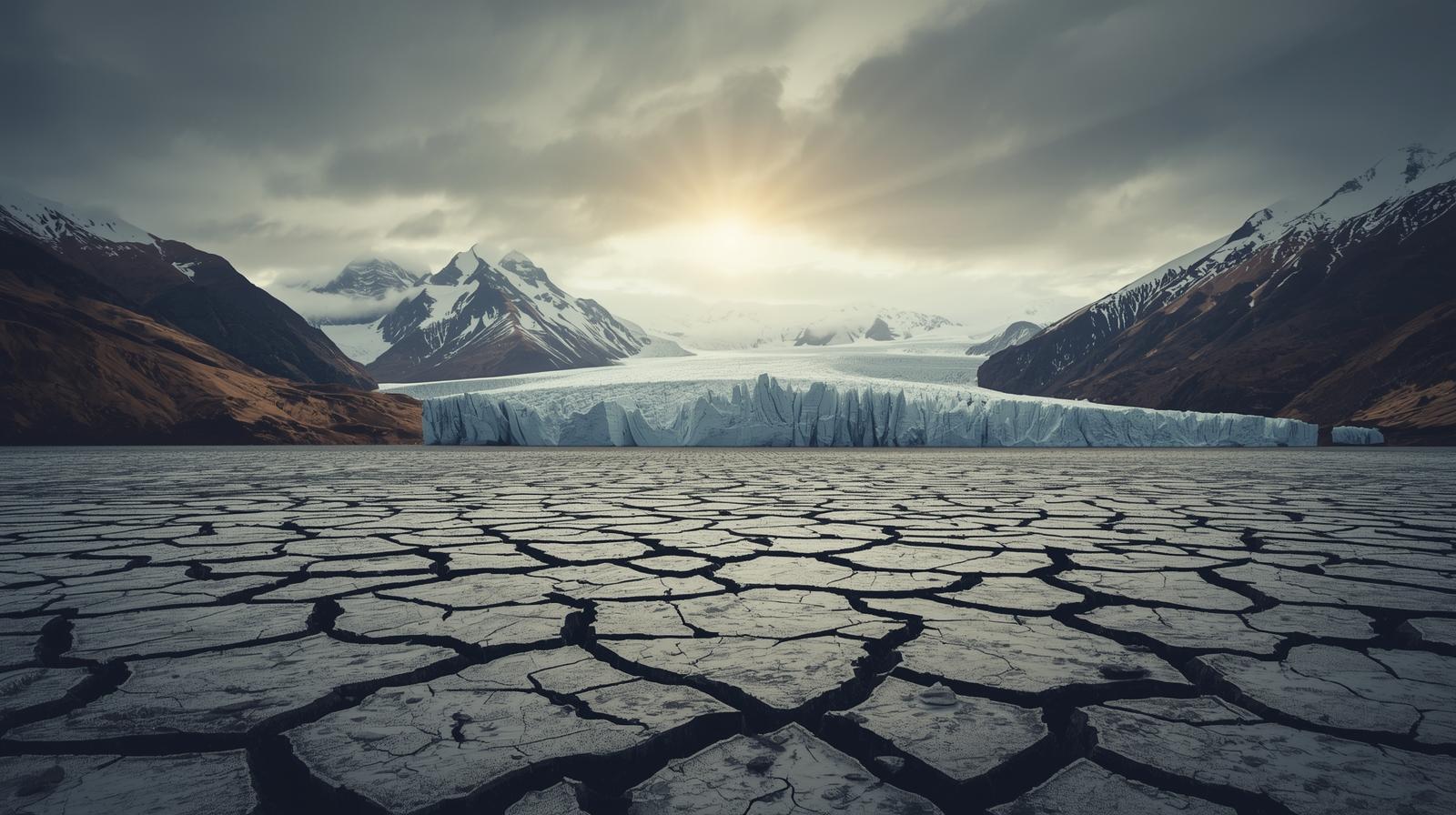
Drought Typologies: Agricultural vs Hydrological
Drought manifests in several distinct forms, each with different impacts. Meteorological drought refers to rainfall deficits, whereas hydrological drought affects stream flow, reservoir levels, and groundwater tables [15]. Agricultural drought, conversely, impacts soil moisture in the top layer (around one meter), directly affecting crop growth conditions [3]. Socioeconomic drought considers how these water deficits affect economic goods like fruits, vegetables, and grains [15]. Under climate change, different drought types show varying responses—agricultural drought signals appear stronger than meteorological drought due to temperature-driven evapotranspiration increases [16]. This distinction is crucial as each drought type requires different adaptation strategies.
Tropical Cyclones and Rapid Intensification Events
Tropical cyclones increasingly undergo rapid intensification (RI)—defined as wind speed increases of at least 35 mph within 24 hours [17]. From 1980-2023, 177 landfalling Atlantic tropical cyclones rapidly intensified, with nearly one-quarter (22%) experiencing extreme intensification exceeding 58 mph in 24 hours [17]. The annual number of RI events in offshore regions has increased by 3.0 per decade since 1980 [18]. Furthermore, 70% of billion-dollar tropical cyclones in the U.S. since 1980 underwent rapid intensification [17]. This trend appears linked to warming ocean temperatures—research indicates human-caused warming has increased the global likelihood of tropical cyclones developing into major hurricanes by approximately 5% per decade since 1979 [17].
Compound and Cascading Climate Events
Beyond individual extreme weather events, research increasingly focuses on compound and cascading climate events where multiple hazards overlap or trigger chains of impacts with amplified effects.
Concurrent Heat and Drought Events in 2023–2024
Compound drought and heatwave (CDHW) events pose heightened risks as they intensify damage to ecosystems, economies, and societies [1]. Research shows these combined events can exacerbate water shortages, crop failures, reduced primary production, and increased wildfire risk [1]. Recent studies reveal a seasonality pattern in CDHW events—droughts and heatwaves display negative correlation during winter months yet positive correlation in other seasons [1]. Most research has primarily focused on summer CDHWs, yet evidence suggests winter compound events can nonetheless impact insects, birds, and wildfire occurrence [1]. Fundamentally, understanding how these events interact requires precise measurement—typically using a daily scale methodology rather than monthly resolution to accurately identify CDHW start and end dates [1].
Fire Weather Conditions in Mediterranean and Australia
Australia has experienced a striking 56% increase in extreme fire weather days over the past four decades (1979-2019), coupled with a fire season extended by 27 additional days [19]. This rate nearly matches global trends, where extreme fire weather days increased by 54% during the same period [19]. Long-term climate change is clearly driving these increasing trends [19]. In regions like Southern California that share Australia’s Mediterranean climate, similar patterns emerge—tropical expansion has shifted rainfall patterns, creating “climate whiplash” where exceptionally wet years fuel vegetation growth followed by extreme drying that provides ample wildfire fuel [20]. Under projected warming scenarios, bushfire risk will likely intensify, with a 5-10% precipitation decline expected across Mediterranean climate regions this century [20].
Compound Flooding: Rainfall + Storm Surge Interactions
Coastal areas face unique risks from compound flooding—where extreme storm surges and heavy precipitation occur simultaneously or in succession [6]. Studies along China’s coastline reveal the Yellow Sea and East China Sea exhibit higher dependence between these factors compared to the Bohai Sea and South China Sea [6]. Projections indicate substantial increases in compound flooding events, with models showing increases between 23.9% and 119.47% for 2015-2050 compared to 1979-2014 [6]. Research using hydrodynamic models identifies three distinct flood zones: areas dominated by rainfall, areas dominated by storm surge, and transitional zones influenced by both factors [7]. Identifying these zones helps determine appropriate mitigation strategies—flood gates for coastal zones, drainage improvements for rainfall-dominated areas, or combined approaches for transitional zones [7].
Projections at 1.5°C, 2°C, and 4°C Warming Levels
Research reveals striking patterns in how extreme weather will intensify under different warming scenarios. As we examine projections, the data points toward concerning trends even at lower warming thresholds.
Scaling of TXx and TNn with Global Mean Temperature
Temperature extremes demonstrate clear scaling relationships with global warming. The hottest day temperatures (TXx) and coldest night temperatures (TNn) both increase faster than global mean temperature—with TNn rising approximately 70% faster and TXx about 30% faster over land areas [8]. This scaling remains remarkably consistent regardless of emission scenarios [8]. Certain regions face even greater amplification: mid-latitude and semi-arid areas could see maximum temperatures rising at 1.5-2 times the global rate [11], creating challenges for adaptation strategies.
Projected Frequency of 1-in-50 Year Events by 2050
Currently rare extreme events will become increasingly common. Relative to present conditions, extreme temperature changes would at minimum double at 2°C warming and quadruple at 3°C compared to impacts at 1.5°C [11]. Even more concerning, the frequency of hot extremes increases nonlinearly with global warming, with proportionally larger jumps for rarer events [11]. Heavy precipitation intensity follows the Clausius-Clapeyron relation, increasing approximately 7% per 1°C of warming [11]. In New Zealand, one degree of warming translates to roughly 13.5% higher rainfall per hour in once-in-50-year events [9].
Regional Hotspots: Arctic, South Asia, and Sahel
The Arctic faces the most dramatic changes, with coldest days warming about three times faster than the global average [11]. South Asia stands particularly vulnerable—800 million people depend on glacial meltwater from high mountains of Asia, and around one-third of this ice would be lost at 1.5°C warming [21]. The Sahel region faces severe challenges as warming continues, with more regions affected by agricultural and ecological droughts at higher warming levels. At 4°C warming, approximately 50% of all inhabited regions would experience increased drought conditions [11]. Furthermore, temperatures in the Middle East could potentially reach 60°C on the hottest days under 4°C global warming [10].
Conclusion
Climate change represents one of the most pressing challenges facing humanity today. The staggering 400% increase in extreme weather events since 1950 clearly demonstrates the accelerating impact of global warming on our planet. These events no longer qualify as mere statistical anomalies but rather indicate fundamental shifts in Earth’s climate systems.
Evidence overwhelmingly points to human influence as the primary driver behind these changes. Greenhouse gas emissions have created a persistent energy imbalance, while land use changes and urbanization further exacerbate these effects, particularly through urban heat islands that trap warmth and elevate nighttime temperatures.
The various extreme weather manifestations—heatwaves tripling since 1980, increasingly frequent heavy precipitation, changing drought patterns, and rapidly intensifying tropical cyclones—all follow predictable physical principles as our planet warms. Particularly concerning, however, are compound events where multiple hazards coincide, creating cascading effects that amplify damage to ecosystems, economies, and communities.
Temperature projections paint a sobering picture. Even modest warming scenarios predict significant increases in extreme events. At 2°C warming, rare extreme events would at minimum double compared to 1.5°C scenarios. This nonlinear relationship means each fraction of a degree matters tremendously.
Regional disparities add another layer of complexity. The Arctic faces warming three times faster than global averages, while South Asia and the Sahel region confront severe vulnerabilities that threaten hundreds of millions of people. Additionally, Mediterranean climate regions will likely experience intensified fire weather conditions and reduced precipitation.
Adaptation strategies must therefore account for both the current reality of extreme weather and its projected intensification. Though the challenges appear daunting, understanding these patterns provides valuable guidance for communities and policymakers as they prepare for climate disruptions ahead. The data presented throughout this analysis underscores an undeniable fact—climate action today directly determines which warming scenario becomes our shared future.